Soil Surveys, Environmental Assessment & Land Management
Why is a Soil Survey Important?
It is important to have a detailed knowledge of soil characteristics and their distribution within a site so that informed decisions can be made about land use to ensure their protection from damage.
What is a Soil Survey?
A soil survey identifies soil resources within a site and groups them into soil types. Soil types share common properties such as texture, drainage and stoniness.
There are various applications of soil resource surveys:
- Soil management plans for development projects - ensuring sustainability through the protection of soils for reuse during construction work.
- Mine, quarry and landfill planning and restoration - a survey will identify soil resources for reuse, giving estimated yields, soil protection measures and restoration advice.
- Forestry and woodland creation and management - to advise on the suitability of soils for different tree species.
- Agricultural Land Classification - needed to inform planning decisions which may affect greenfield sites.
Why is a Soil Survey Necessary?
Agricultural Land Classification is required as part of the planning application for greenfield land that may involve the loss of Best and Most Versatile (BMV) agricultural land. Soil Management Plans (SMP) and Soil Resource Surveys (SRS) are also becoming an increasingly common condition of planning permissions in the development sites. They show the areas, types and characteristics of topsoil and subsoil available on site and advise on best practice for resource protection and suitability for reuse in cases where land is being disturbed. A soil survey is best conducted at the early stages of a development project to make the most out of the detailed information.
How is a Soil Survey Conducted?
A soil survey should be undertaken by a suitably qualified and experienced soil scientist. The Land Research Associates have been carrying out soil surveys for over 29 years with unrivalled skills and experience as a specialist soil science consultancy.
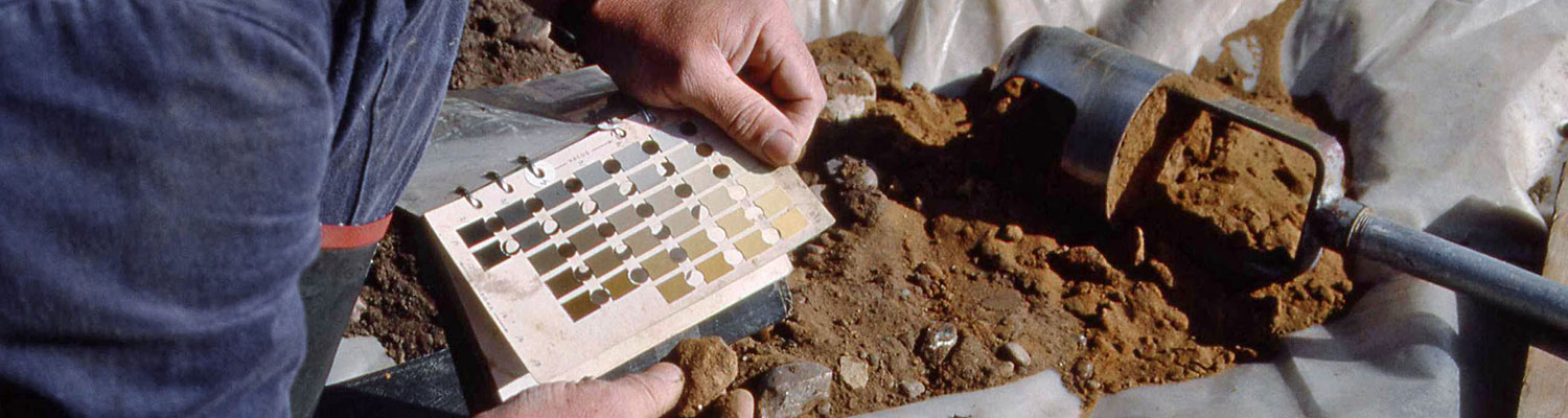
Soil surveys are typically carried out using hand-held equipment (Dutch auger and shovel) with observations carried out at a density of at least one per hectare, with increased density for smaller sites. The survey will identify topsoil and subsoil resources noting their physical properties (e.g. texture, stoniness), chemical properties (e.g. nutrients where applicable), and depths.
A good soil survey will:
- Provide detailed descriptions of the different soil types including thickness and the characteristics of the surface and subsurface layers within each type, and the results of lab analyses (where required for landscaping or movement of resources off-site).
- Assess the suitability of the different soil resources for reuse on or off-site.
- Provide site-specific advice for best practice soil handling, management and reinstatement, including remediation advice for soil damage.
Get in touch to find out more information about soil surveys and organise one of our experts to come and visit your site.